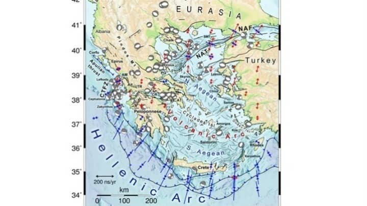
A 'Seismotectonic Atlas of Greece', which will serve as a basis for realistically estimating earthquake risk throughout the country, is being prepared for the first time by Greek geoscientists.
Their aim is to record the momentum of ground deformation in Greece, updated with the latest information available.
The project was outlined to the Athens-Macedonian News Agency by its coordinator Ioannis Kassaras, an assistant Professor of Geophysics at the Athens University Department of Geology and GeoEnvironment.
Seismotectonics aims to relate earthquake activity to active rifts and the deformation of the Earth’s crust, leading to estimates of earthquake risk.
Kassaras noted that the first 'Seismotectonic Map of Greece’ was published in 1989, however much has changed since then.
“There has been rapid progress in the geosciences, both internationally and on a national level, given the development of digital technology, satellite applications, more advanced methodologies and a host of computing tools, as well as the availability of a great volume of high definition instrumental observations,” he stated.
