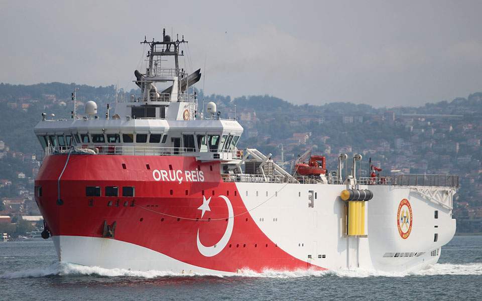
Turkey issued a Navigation Telex (NAVTEX) announcing an extension to the Oruc Reis' research activities in the Eastern Mediterranean, south of the island of Kastellorizo, valid until August 27.
The survey concerns research vessels Oruc Reis, Ataman and Cengiz Han in an area bounded by the following coordinates: 33 55.22 N - 027 59.83 E; 34 58.25 N - 030 31.50 E 34 18.18 N - 030 54.52 E; 34 17.03 N - 030 06.12 E; 33 49.84 N - 030 06.78 E; 33 41.25 N - 028 46.16 E; 33 47.41 N - 028 21.48 E; 33 53.37 N - 027 59.90 E.
According to sources, 'Oruc Reis' is sailing in the Greek continental shelf in a southwesterly direction and in the area specified in the previously illegally issued Turkish NAVTEX, which expired at midnight.
It is accompanied by auxiliary vessels of the Turkish Navy and is monitored by the Greek Armed Forces.
Regarding the extension of the illegal Turkish NAVTEX, Greek government officials stated the following: "By continuing its provocative behaviour, Turkey is only showing the world that the reference to international law and dialogue is purely superficial. With this behaviour, the only thing it succeeds is having negative consequences for their country."
