Turkey is further escalating its provocations in the Eastern Mediterranean, openly threatening with drilling and research in areas where Greece and Cyprus have rights.
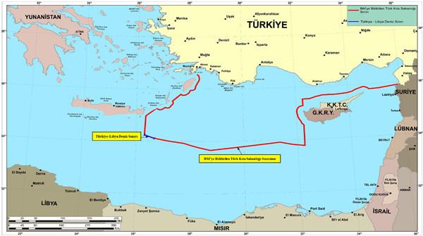
The maps that the Turkish Defense Ministry released completely ignore the agreement on EEZ (Exclusive Economic Zone) between Greece and Egypt, taking the Turkish continental shelf until Kasos, Rhodes, six miles from Pafos and include the area of the illegal Turkish-Libyan memorandum.
While releasing the maps, the Turkish Ministry said that “We continue normally with the Blue Fatherland doctrine.”
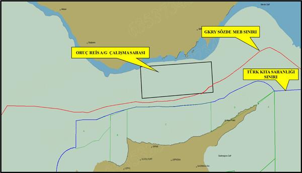
According to the announcement, within the framework of collecting seismic data on behalf of the Turkish Petroleum Corporation (TPAO) and of drilling activities, the activities of the vessels Oruc Reis in the Mediterranean and of Barbaros Hayreddin Pasa in the Black Sea, as well as the drillships Kanuni and Fatih, and ship Denar-2 continue accompanied by the forces of the Turkish Navy and Air Force.
The Ministry also presented a map of the continental shelf on the basis of the agreement signed with the so-called Turkish Republic of Northern Cyprus in 2011 and was released to the UN on 2020.
SKAI correspondent in Turkey Manolis Kostidis explained that a map was notified to the UN 1.5 years ago in a period of great tension with Greece, and now Ankara is bringing it back to the table.
The maps and parallel threats to the investigation are a continuation of the provocative actions by Turkey. A few days ago, Foreign Minister Mevlüt Çavuşoλουlu spoke of a unilateral declaration of an EEZ by Turkey, while a letter was sent to the UN in which Ankara openly contested the sovereignty of the Greek islands.
