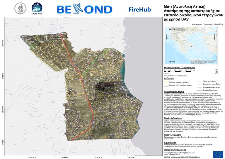
Updated detailed maps show that 70% of the fire-stricken area of Mati in eastern Attica was completely burnt from the wildfires on July 23rd, by the National Observatory of Athens.
The remaining 30% is either partially burned or contains burnt areas.
The map reveals that a little far east of Marathonas Avenue, in the heart of Mati, there is a totally black area from the fires.
The maps were taken two days after the tragedy and are thoroughly accurate. Using a system of Drones/UAV for high-resolution spatial analysis, the Beyond centre has produced very detailed maps assessing the damage to even individual properties.
The map covers a burnt area of 4,318 acres, which is about a third of the total burned area in eastern Attica. Eastern Attica as a whole is around 12,600 acres.
The purpose of the map is to provide “useful information for the needs of the Ministry of Infrastructure and Transport, in order to manage and restore damaged property.” stated the National Observatory of Athens.