
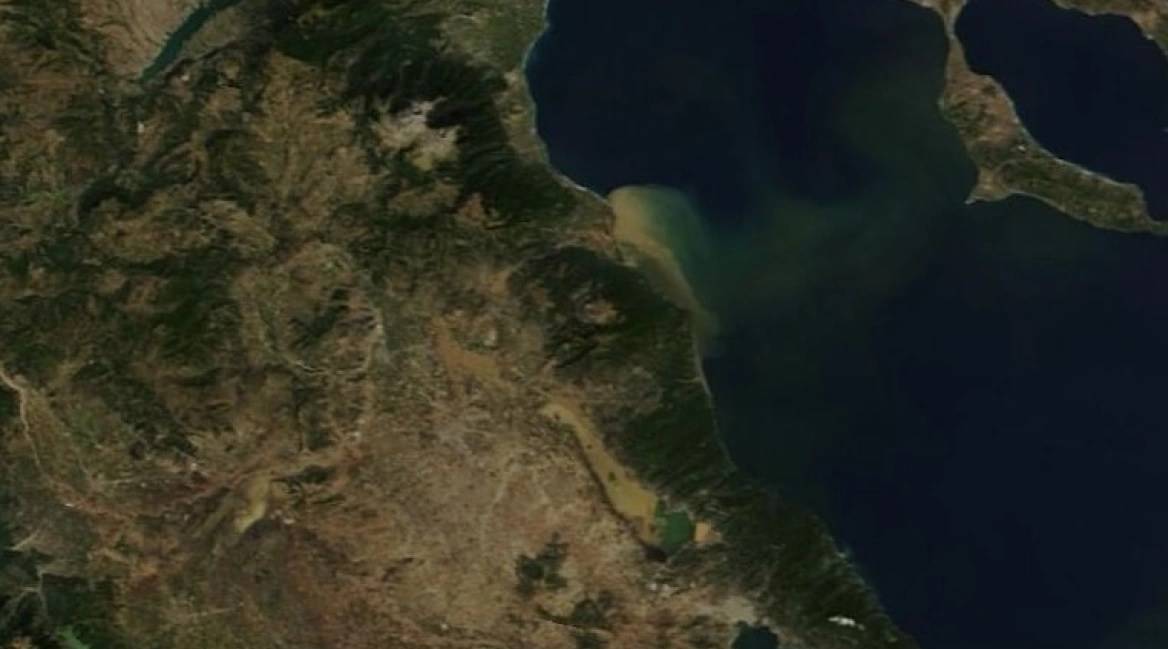
The size and intensity of the consequences of the storm Daniel that flooded areas of Thessaly and Magnesia is revealed by another satellite photo.
In this photo, it can be seen that the mud and the transported materials that Pinios “brought out” to the sea crossed the Thermaikos and reached the coasts of Halkidiki.
As seen in the photo, a strip of mud has formed that ends at the first “leg” of Halkidiki.
See the photo:
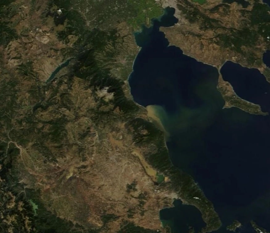
As pointed out on social media, on the one hand there is a danger from the materials carried on the boats passing through the area and on the other hand the question arises whether the waters through which this mud has passed are suitable for swimming.
“It is good to take measurements anyway to clarify and to have an official update from the respective agencies, since a lot of people are still visiting the coasts” notes the user who uploaded the photo to the Weather Analysis Group page.
READ MORE: 8,500 Year Old Ancient Stilted Village Discovered North of Greece, Submerged in Lake.
Styliana Averkiou, a 25-year-old makeup artist and fiancée of Cypriot YouTuber and MEP Fidia Panayiotou,…
Maria Sakkari of Greece outclassed Jasmine Paolini 6-2, 6-1 in the round of 32 at…
Cracks in roads and homes in the Voutes area southwest of Iraklio, Crete, likely caused…
Nammos Resort AMAALA, Greece’s iconic beach club brand’s first international venture, will open in Saudi…
Klavdia Papadhópoulos will represent Greece at Eurovision 2025 with her powerful song Asteromáta, a tribute…
Greece is launching its first online platform allowing citizens to rate public services, aiming to…


