
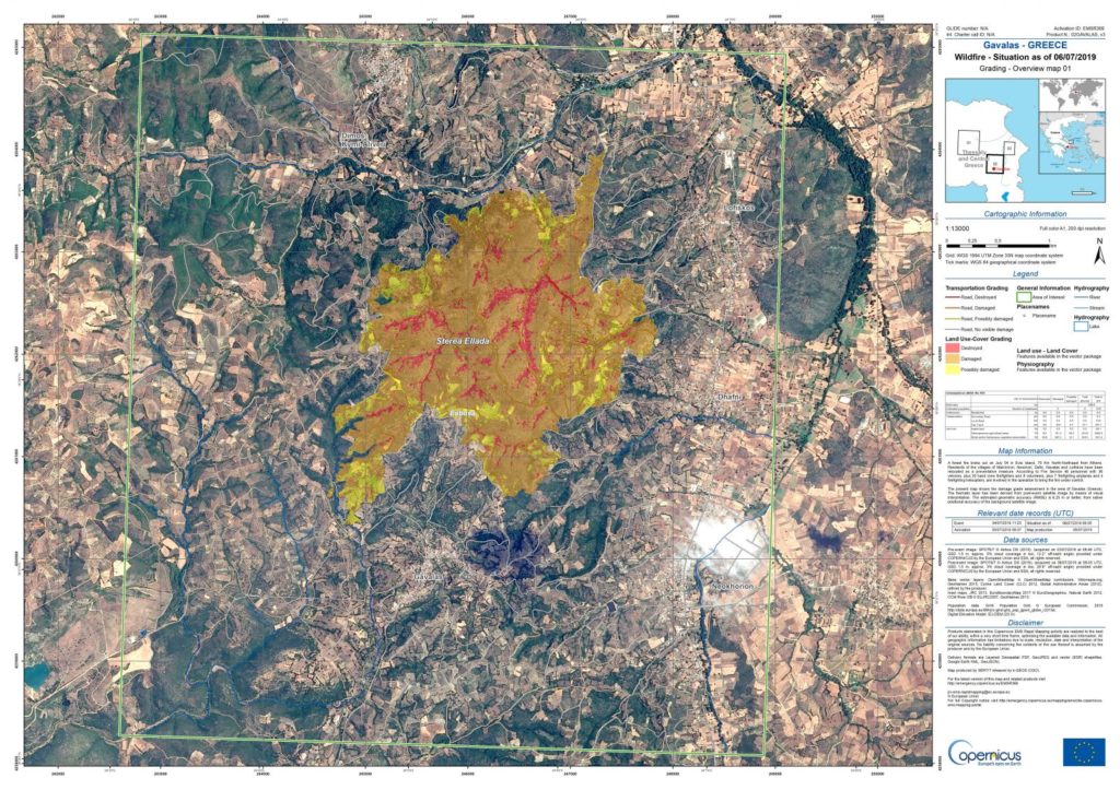
The first mapping of the land that was set on fire in Euboea last week was released today by state news agency ANA.
With the contribution of the EU Copernicus system, the burned areas are clearly mapped, confirming that mainly forest and crops were burnt.
The Copernicus service was activated on Tuesday, August 13, at the request of the Greek authorities (SG Civil Protection) and has since been recording via satellite the evolution of the fire, providing useful high-resolution data on the extent of the disaster.
The full data and mapping can be seen here.
The map that Copernicus released today shows in detail the distribution of land uses (as recorded in 2018) of areas burned down till Wednesday 14th August.
Given that the fires have since been reignited and moved through areas it had already passed, it is estimated that the geographical area imprinted here is not far from the total burnt area to date.
The overcast weather on Thursday and Friday prevented accurate satellite recording on new data. The next satellite recording attempt is expected today, Saturday, if the weather permits.
What we do know is that in the first two days of the fire, mainly coniferous and hardwood forests, transitional bush areas, olive groves and fields with mixed or non-irrigated crops, as well as natural vegetation became ash.