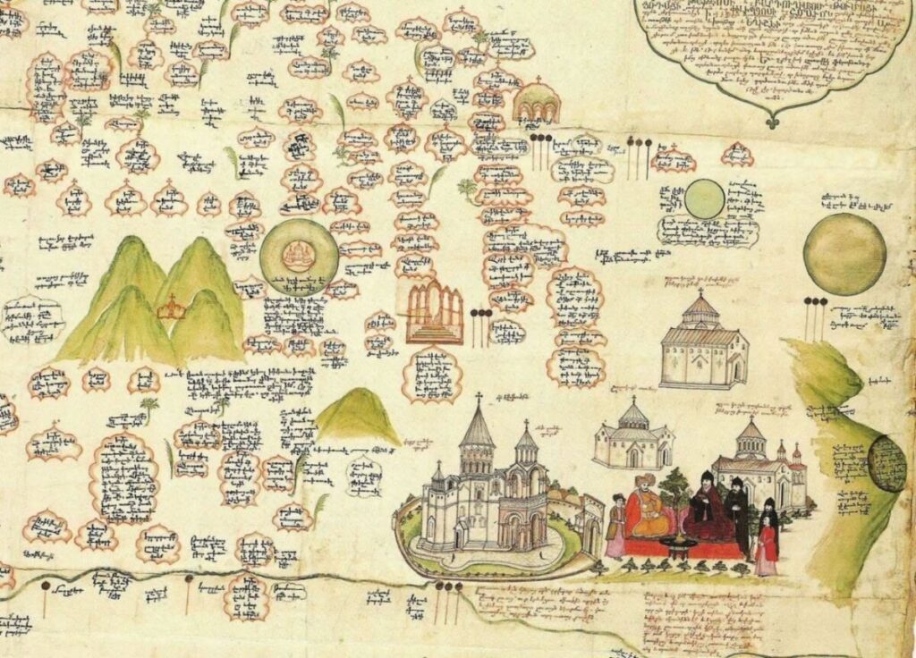
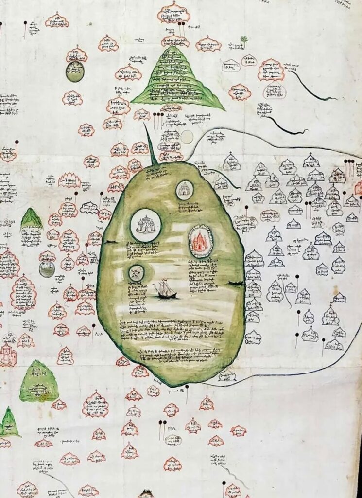
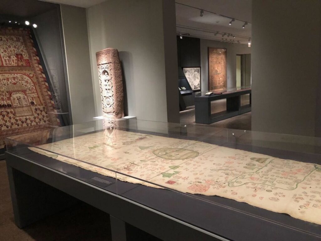
The Medieval map of Armenian monasteries and sanctuaries created in 1691 is stored in Bologna, Italy. The map is unique in being one of the first handwritten maps in the Armenian language. It displays a comprehensive overview of the traditional worship sites of the historical Armenian territory from the 4th to the 17th centuries. It depicts hundreds of monasteries and the main ecclesiastical centres.
This map was created by two remarkable players in the political and cultural arena of the late 1600s: Eremia Chelebi Keomiwrchean, the Armenian intellectual, poet, and Italian Luigi Ferdinando Marsili, who was a scientist and cartographer as well as an Italian diplomat and military man.
The map is stored in Italy in the University Library of Bologna; like other historical libraries of Italy, it has many ancient documents in the Armenian language, both manuscripts and prints, demonstrating the well-established cultural relations between Italy and the Armenian people since the Early Middle Ages.
Three illuminated manuscripts and nine printed volumes stand out, each representing a particular moment in Italian-Armenian relations or, more generally, of the contacts between the Armenians, Italy and Europe through printing.
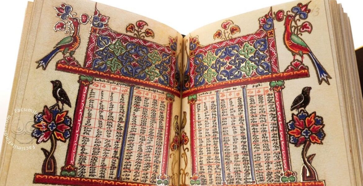
The Armenian Bible is also stored there and is considered one of Europe's most significant Bibles.
Written and illuminated in the sixteenth century, the manuscript features twenty-six lavishly illuminated full-page miniatures consistent with the Armenian rules of book painting, representing one of the few examples that survived time reaching modern days.
You can follow Lianna Agasyan on X.
READ MORE: King Tiridates III - The first Armenian to participate and win the Olympic Games.
