From 2017 to August 13, 2024, 13 major wildfires have burned over 700,000 acres.
Significant and concerning results emerge from the updated analysis of burned areas due to wildfires over the past 8 years (2017-present) in the mainland section of the Attica Region.
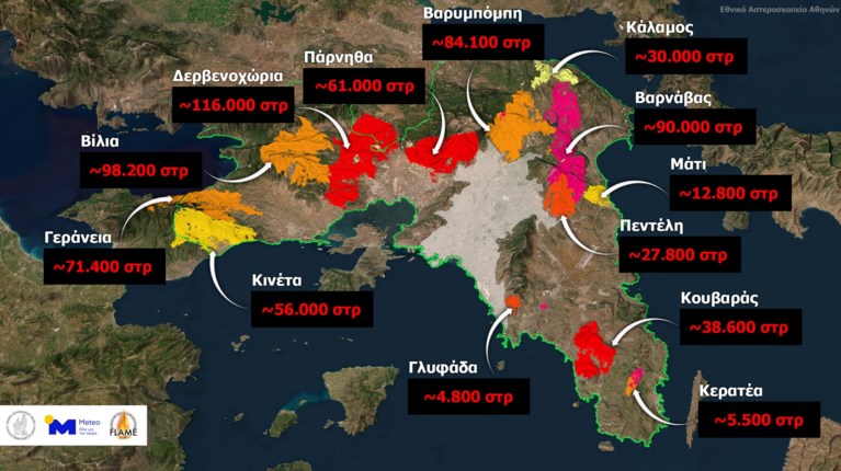
As reported by Meteo, from 2017 to August 13, 2024, 13 major wildfires have burned more than 700,000 acres according to reports from the Copernicus Rapid Mapping Service and the European Forest Fire Information System (EFFIS). The perimeter of the burned areas is shown on the accompanying map.
Souglakos: Different management strategies needed for forests—Preventive measures and a shift in strategy
The total area of the Attica Region (excluding the Troizinia area, the islands, and the Athens Basin) is 2,500,000 acres, meaning that in the past 8 years, 26% of the total area has burned due to wildfires. In the Attica Region, the area of forested land is approximately 1,230,000 acres, and over the last 8 years, 450,000 acres of forest have burned, equivalent to 37% of the forested area. The recent fire that started from Varnavas in Attica reached the residential zone of the Athens Basin, burning a large section of forested land in Northeast Attica.